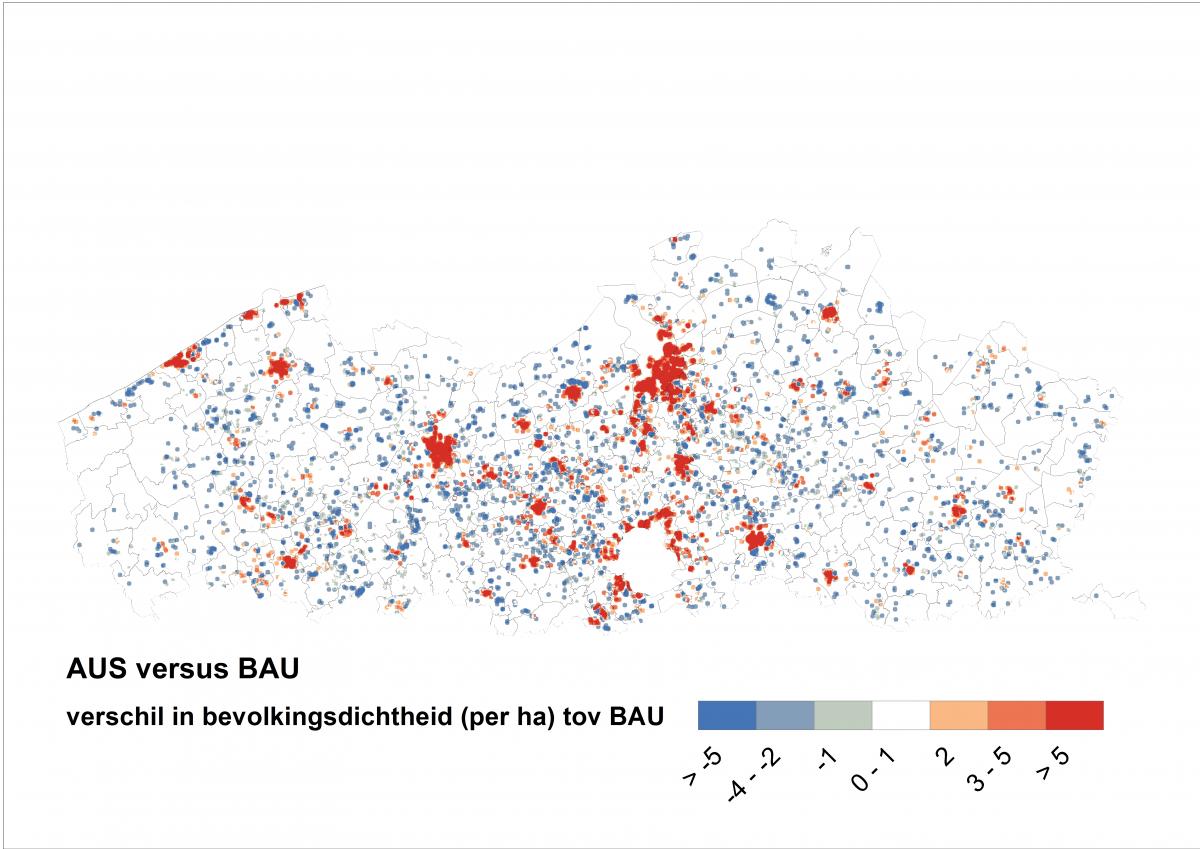
Land-use simulations are carried out with the Simulation Tool. The Simulation Tool uses a land-use model based on Cellular Automata and generates annual output maps for the desired time period. The model is typically applied at a medium-scale resolution (up to 1 hectare). This tool is used for the implementation and analysis of land-use scenarios. These scenarios simulate autonomous developments in accordance with the observed land-use dynamics in the past on the one hand, and a set of spatial datasets and feedbacks in the present on the other hand. In addition, the SimulationTool can be used to test the impact of various policy choices. For example, what if the policy would encourage densification? What will your region look like in 2050 when a zero land-take policy is introduced?