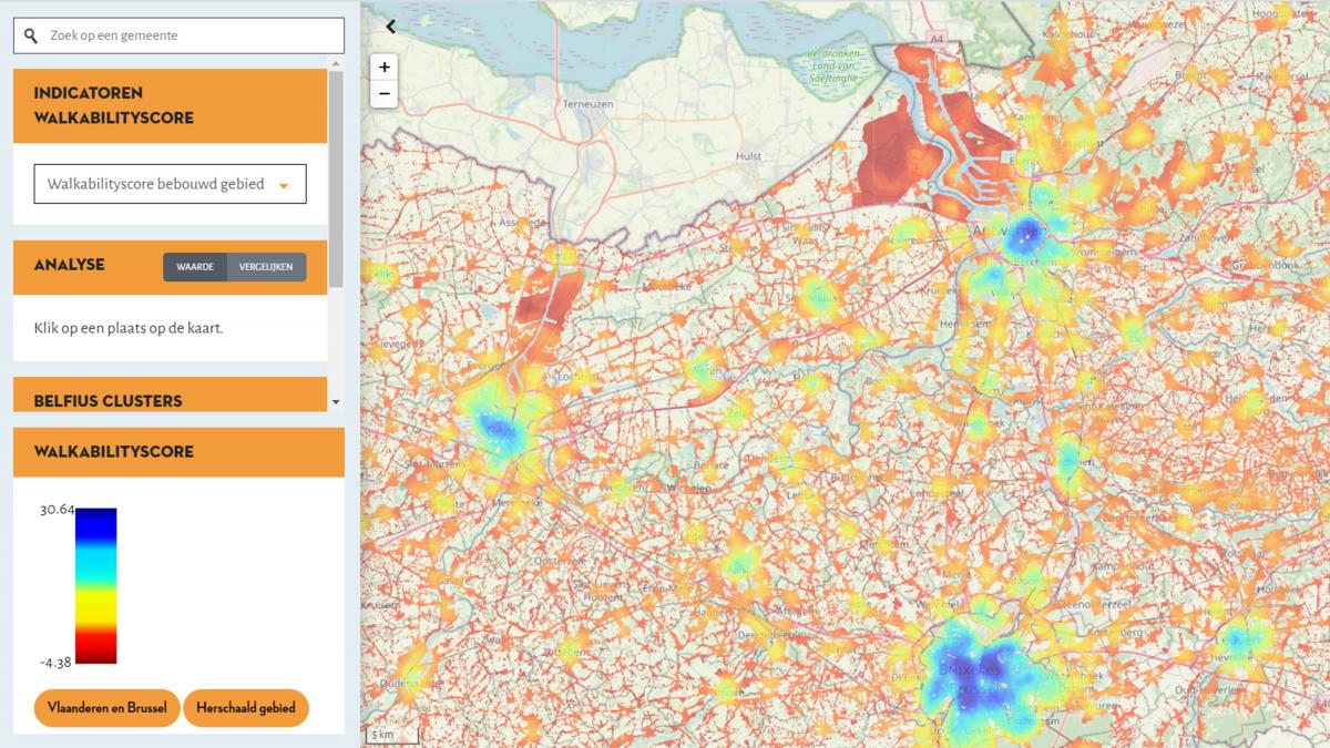
How do you know if a neighbourhood has more or less potential for active travel? Tailor-made sustainable spatial policy requires insight into the 'walkability' of neighbourhoods.
VITO operationalized the scientific method to measure walkability by developing an area-wide map of Flanders at high resolution (1 ha) and published this map in an online tool that allows users to investigate neighbourhoods in more detail.
The walkability score tool offers steering handles to evaluate alternative policy measures that can be taken from a health perspective. The tool helps you to indicate which neighbourhoods are in need for changes in the organization of their public space and to well-found your choice.
Commissioned by: Flemish institute for Healthy Living and Flemish government department Environment
2017-2018, 2019, 2020