Flemish water emission inventory
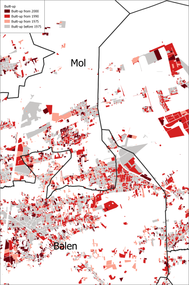
In 2019 the newspaper ‘De Standaard’ published an article on urban sprawl and land take in Flanders. To reinforce the message, there was a need for maps that visualized the phases of land take at parcel level between 1975 and 2015. A spatial analysis was conducted to map patterns of urban expansion for all municipalities of Flanders.
The underlying dataset for this analysis was derived from the Global Human Settlement Layer (GHSL), developed by the Joint Research Centre of the European Commission. This dataset uses satellite imagery to identify built-up areas at a spatial resolution of 30x30 meters. As pixel-based data can become less interpretable at finer scales, the built-up pixels were translated to cadastral parcels through a spatial overlay with the national land registry dataset, focusing on parcels identified as built-up.
While this method allows for a more interpretable and spatially explicit representation of construction dynamics, it is not without limitations. Due to the coarse resolution of the GHSL data, isolated buildings and smaller developments may go undetected. Furthermore, built-up areas located in densely vegetated or tree-covered zones may be underrepresented, as vegetation cover can obscure built-up surfaces in satellite imagery. To address this, infill based on spatial proximity was applied: if neighboring parcels were identified as having been constructed during a specific period, adjacent parcels without known construction dates were assumed to belong to the same period, based on the logic of contiguous development. However, this introduces a degree of uncertainty.
The primary aim of this mapping exercise was not to pinpoint exact construction years for individual buildings, but rather to visualize broader spatial patterns of land take, including the expansion of residential subdivisions, ribbon development, urban fringes, and scattered development in rural areas. The results were published by De Standaard as part of a web-based platform accompanying a 2019 article series on urban sprawl and land consumption in Flanders, referred to as the “Betonwoede”.
Commissioned by: VITO - in collaboration with the Dutch magazine "De Standaard"
2019

