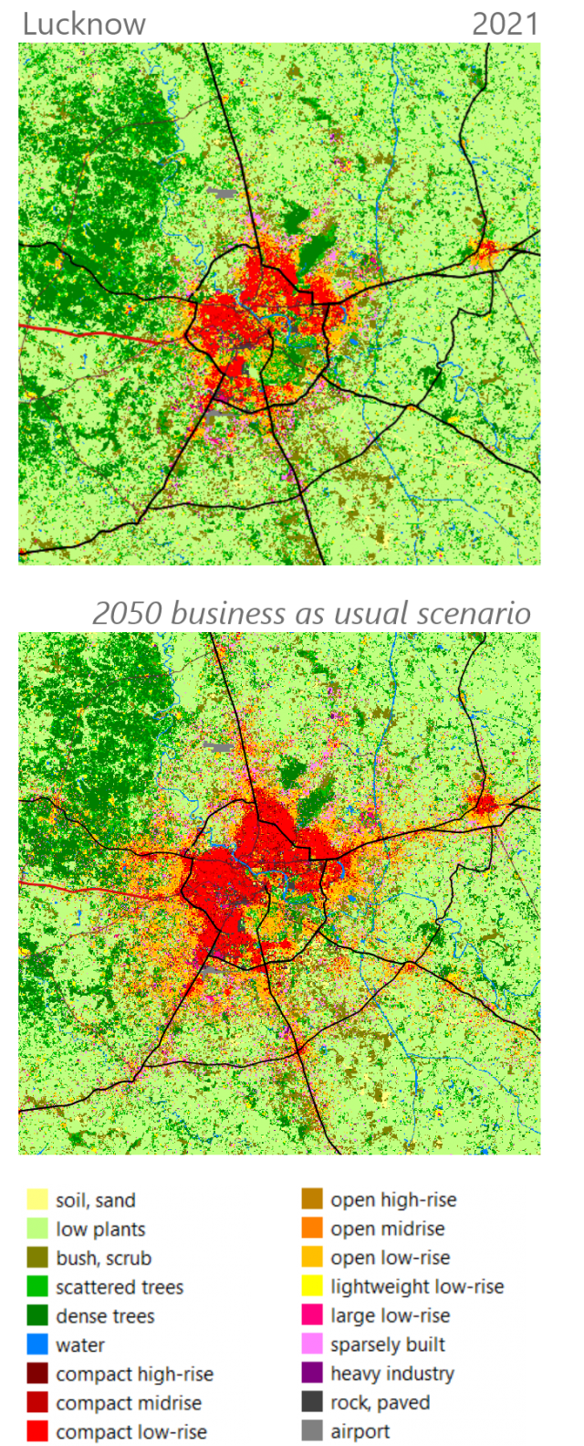
The urban heat island effect leads to higher temperatures in cities compared to rural areas. The combined effect of climate change and strong urban growth will as such have a massive impact on human health in growing large cities, especially in tropical or humid regions. Climate models at a detailed resolution usually do not take urban growth into account or do not have detailed data on the specific characteristics of the urban area.
We developed Local Climate Zone (LCZ) land-cover maps that includes several built-up morphologies based on remote sensing classifications and developed alternative urban growth scenarios for four Indian cities (Bangalore, Lucknow, Guwahati and Ahmedabad). Resulting urban growth maps served as input to model present and future urban climate, and to calculate different climate and health indicators for all cities
The resulting maps aims to trigger climate action that leads to an enhanced climate resilience in Indian cities.
Commissioned by the Flemish government in the context of international climate financing projects 2020
2020-2023

