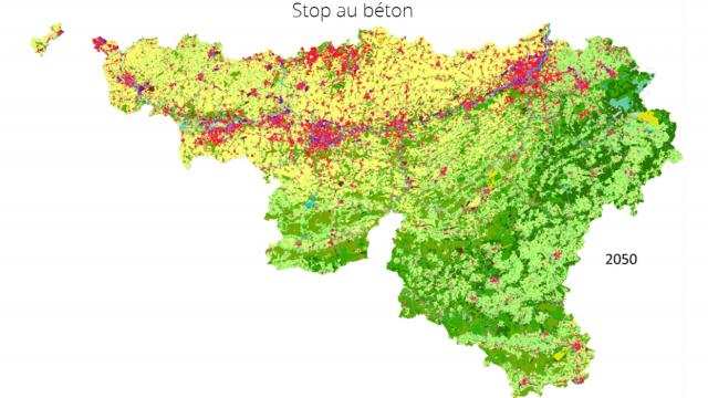
Studying the risks related to urbanization requires precise geodata and models. Yearly and dynamic (night - day, week day - weekend) population maps and up-to-date Land Use and Land Cover data can improve the assessment of impacts related to environmental hazards.
VITO supported the SMARTPOP project through implementing and applying our activity-based Cellular Automata land-use model for Wallonia.
The outputs can be used as decision-support tools by authorities dealing with spatial planning and environmental monitoring.
Supported by BELSPO, in collaboration with ISSeP (Institut Scientifique de Service Public) and ULB - IGEAT - ANAGEO (Analyse Géospatiale)

