In Morocco, the last census confirmed the polarization dynamics of the population around big
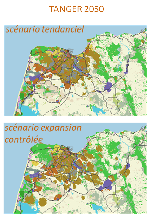
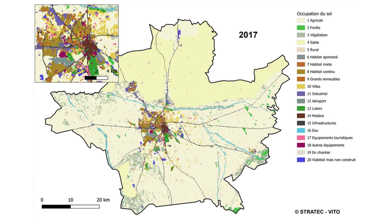
Stratec and VITO carried out a spatial analysis and spatial-dynamic modelling at the detailed level of building structures and patterns (i.e. high rise, villa neighborhoods, industrial areas …) which were defined and identified by means of machine learning techniques and GIS analysis. Alternative growth scenarios were simulated for two case studies: Tanger and Marrakech. Three policy strategies (stronger zoning regulations, stimulating a shift towards more dense growth patterns, or creating decentralized growth locations) are simulated and compared with a business-as-usual scenario. Finally, an updated scenario was prepared that combined densification and well-chosen zoning regulations.
The resulting maps of potential future land use patterns for Tanger and Marrakech allow policy makers to counteract the negative effects of urban sprawl.
Commissioned by: Ministère de l’Aménagement du Territoire National, de l’Urbanisme, de l’Habitat et de la Politique de la Ville Département de l’Aménagement du Territoire et de l’Urbanisme (Ministry responsible for urban planning)
2017-2021