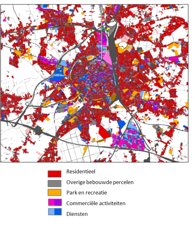
Flanders is densely populated and experiencing pressure due to a growing population. Each additional resident needs space to live, work, recreate and move around. Every year, more land is taken for houses, gardens, industry, as well as parks and recreation areas. This so called ‘settlement area’ needs to be monitored over time to support a transition towards more sustainable land use.
Since 2013, VITO is monitoring the land cover and land use of Flanders in a ‘land use database’. The land use database consists of high resolution (10x10m²) land use maps. The land use database is based on the combination of the best available spatial information in Flanders. The results are made available via Geopunt. The goal is to update the dataset every three years.
The land use database forms the basis of many spatial analyses that aim to provide a better insight in spatial patterns and processes. Moreover, the data is used to carry out policy-supporting modeling and are the basis of the official statistics for ‘land use’ and ‘settlement area’ in Flanders.
Commissioned by: Flemish government, department Environment
2013-2021

