Flanders is required by Europe to report on the consumption of heat and cold, but the region also has the ambition to support renewable and sustainable energy projects on the local level by making heat demand data available and accessible to local project developers, municipalities, provinces and other stakeholders.
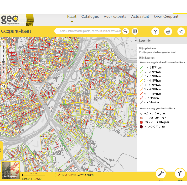
VITO produced a set of 9 maps that can be consulted on the website of Geopunt. The maps show for instance the heat demand of large (point locations) and small consumers (sub street segment). It also contains an overview of the current and planned district heating networks. Finally, also potential locations for the production of waste heat were mapped.
Publishing this heat map data at a high spatial resolution provides insights and offers a stepping stone for the development of local heat zoning plans or future projects on green heat.
Commissioned by: Flemish Energy Agency
2019-2020