GeoDynamiX
A generic toolbox for spatial analysis, dynamic simulation and optimization for land-use dynamics
Modeling spatial solutions for current and future spatial challenges at a regional scale
Reports spatial data and results online and/or offline

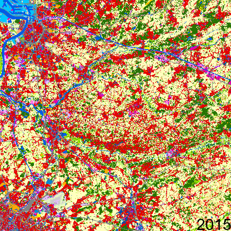
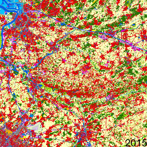
Spatial Analysis
Discover new insights in the land use in your region based on detailed spatial data, spatial indicators and analyses of current land use and spatial patterns.

Simulation
What are the consequences of autonomous developments, policy choices and expected (international) trends on future land use in your region?
Discover the expected and intended land-use changes in your region by using spatial simulations

Optimization
Where are the best locations for the development of business parks, infrastructure, energy production installations, green areas, etc…? Search for the optimal locations based on spatial optimizations.
Founding Fathers
Spatial challenges are not limited to a single administration, policy level, knowledge domain or specialism. They cut right through all these classical divisions. GeoDynamiX is therefore also used by users within various administrations, at the national, regional and local level. In addition to policy choices, our decision support tools are also used to support strategic choices made by private companies.
In order to maximize the exchange of knowledge and to facilitate the use and management of GeoDynamiX, the developers and users are united in the so-called Founding Fathers of GeoDynamiX.

Our experts


Alternative land use scenarios
Discover the impact of policy measures
through simulating alternative land use scenarios
Growth as usual
residential land continues to take land at decreasing densities and open area gets fragmented
Returning open space
residential land take stops thanks to densification in existing built-up area and open area returns